Sunday, January 30, 2011

Relaxing in Hanmer Springs (aka Lothlorien)

(Hi, I'm Josele and I'll write this post and the following posts. We have not had too much time to update the blog these last days, so I'll write two entries, one for our trip and stay in Hanmer Springs, and a second one for our bike trip to Kaikoura... The very good news is that the computers in the YHA of Kaikoura read my Canon SD memory, so I'll be able to post photos in these two entries and add some photos for past entries.)


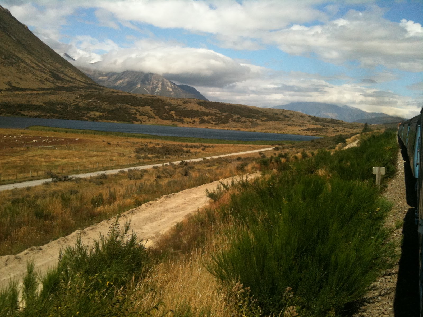
After a great train trip from Arthur Pass, we arrived in Christchurch where we spent only enough time for us to miss the mountains and to walk a bit around the town. Christchurch has very nice gardens, but apart from that we did not see anything really worth the trouble (apart from a short visit to a Starbucks cafe to take some photos with which to try to annoy Daniel the Starbucks-freak). We felt very happy with our change of plans (taking the train so that we could spend only half a day in Christchurch and be able to reach Hanmer Springs with the bike).


So the following day we woke up very early (a bit before 6am) to get another train to Waipara, a small village north of Christchurch, very known by wine connaiseurs as the site of the Pegasus Bay winery... From the train we could see huge plains filled with vineyards, the biggest we have ever seen, all beautifully arranged in rows, with their drip watering system and rose bush in front of each row...

We arrived at Waipara at 8am, and started our 77km. uphill stage to Hanmer Springs (during the day we would climb a bit more than 300 meters)... The trip was tough, but we had some help from the wind and from the nice cafes we stopped along the road, our favourite one in a village called Culverden, the Red Post Cafe:


We also had great views along the trip. This country is amazing, and you never get tired of the wonderful views. The landscape has changed from the West Coast, as it is now drier and more similar to the mountain landscapes you can see in Spain and France, though with no houses...


 Hanmer Springs is a loooong looong village, and it took us the last of our energy reserves to get from the village entrance to our hostel, but we were happy we had one full day to relax after so much biking in the past two weeks... First of all, we had a big Flintstones steak in a local restaurant:


We spent most of our relaxing day in the Hanmer Springs Thermal Pools. We bought the "luxurious package" and received also a well deserved 60-minute massage, exactly what our exhausted body needed after 10 bike stages!... Of course I was more worried about not falling sleep and drowning in the pools than taking pictures, but this day Internet is a great place to find some cool photos of any place you visit. This is a good one I found in http://www.travel-location-blog.com/hanmer-springs-canterbury-nz-120-pictures.htm


And that is all for the moment. I'll make a second entry later during the day about our record breaking Hanmer Springs- Kaikoura bike stage... Now we are off to a winery in Kaikoura where we'll have a tasting and a lunch.

Friday, January 28, 2011

A day without Blog post

Hello all, I was going to post a very nice piece of post, but I have received very bad personal news from Spain I do not think I am in the mood for light (and bad) comedy.
Tomorrow I will try to post, today you'll have to endure the suspense.

Thursday, January 27, 2011

A change of pace

Today we had decided to change the pace of the trip. The remaining 100 kms to Christchurch were going to be very downhill and boring, so we decided to take the train instead of spending two day getting to Christchurch. You'll see in two day what are we going to do with those extra hours...


The train was very, very nice, it is considered one of the most beautiful rides in the world and to be honest it is quite spectacular. We rode over steel bridges and into tunnels, all the while leaving behind the beautiful Alps. I already miss them, Christchurch is really not worth the time we are spending there.


Anyway, I am very short on time, just two more lines to tell you to look back all the old posts! Josele has finally found a way to add photos and you'll see how much better things read with a photo by them! Enjoy!

Tuesday, January 25, 2011

Following the birds

Today we had planned a resting day, after all the energy spent in the last days, we wanted a rest and a change of pace before we move on to bigger cities and other activities. So as we are sleeping in New Zealand's highest village, the best and only reasonable to spend our day resting is to a full day hike of more than 1000 mts climb. Obviously!


We got up and got the weather report, that seemed favorable, so we proceeded to climb Avalanche peak, a 1820 mts peak right on top of the village of Arthur's Pass. Very soon we were looking down into the pass and  the whole valley and seeing how the mountains around us got lower and lower. We did a very steep climb up a path called Scott's track and we got almost to the top.


At something like 50 mts in altitude  from the peak, we decided to turn round because the weather was turning and the wind and clouds looked dangerous.


The path is extremely steep and we did not want to be caught in a storm in that very exposed ledge, so we were prudent, went down and completed the hiking day with a very nice visit to a nearby waterfall, very romantic and all.


The only pity is that today we did not see many Keas, the famed alpine parrots from New Zealand. Officially there are less than 5000 left, but if so, we have seen probably 4000 of them already. we saw plenty in teh Milford Track, in Hasst Pass, yesterday in Arthur's Pass I saw five or six and they were int he village attacking the tourists... but we did not see then in the top of Avalanche Peak, where you are supposed to go to look for them! Anyway, I also want to declare Josele an official bird nerd, he has taken photos, read about and generally studied all the strange weird birds in the island. And believe me, there are many different types of wingless chickens prancing around this place. Well, by now, Josele knows them all! The Kea, the Weka, the Kiwi and the Wakakakaka, all of them...


The day has turned to rain, but we hope it passes by tonight so tomorrow we can go on enjoying the AMAZING weather we've had up to now.
Tomorrow, phase six!

Edit: This is what i mean when I say "extremely steep"...

Monday, January 24, 2011

Greymouth-Westport, one of the most beautiful scenic drives in the world

(Hi, I'm Josele; as we split in Hokitika, I'll tell my part of the journey until Arthur's Pass, aka Moria)

After leaving Fox Glacier I started feeling lazy and decided not to climb to Arthur's Pass with the bike, so I did an easy 40km. flat short stage to Greymouth and rented a car there. Greymouth was not too interesting (at least what I saw while biking) and I found Hokitika prettier.


We had met a couple of Slovenians during the Milford Track and they had told me that the stretch of road between Westport and Greymouth (100km. long) was the most beautiful road they had seen in the country (they had a camper van), so I was curious to see it... Later, I checked in the Lonely Planet, and they have put it in their Top Ten Scenic Drives in the World, so if you like driving and come nearby, think about doing it, because it is well worth it.

The drive is without doubt the best I've ever done in my life. Ok, I don't have a lot of expertise driving in amazing roads, but it's comparable (to me, even more beautiful) to the scenic drives between Nice and Monaco, and the route 1 south of San Francisco in western US (which I had the luck to drive).


The road meanders through valleys (with many curves with 25 or 35 kph limit), the mountains covered with rainforest. At times, it gets closer to the sea, and then you find yourself awing at 50+m. tall cliffs over the sea. The whole coastline is dotted with the famous "pancake rocks" of New Zealand's West Coast... They are limestone rocks, formed approx. 150 million years ago from the fossilized remains of many long dead animals, fused with the rocks that emerge from the ocean (this area is where the Pacific and Asian tectonic plates meet). Some 100 thousand years ago, the rocks emerged from the bottom of the sea, and the water has been constantly eroding them, taking away the softest bits (the fossilized animals) and leaving only the hardest parts of the rocks, thus giving them the shape of stacked pancakes.


The coast has also many more things to see, although I only had time to visit a seal colony, 10 km. to the south of Westport. I had a lot of time, so I could thorougly enjoy the drive, never doing much more than 55-60 kph. I think I was also lucky with the light, as the sun was shining from the see and I could take really nice photos.


Talking about photos, I have loads of them to share, but the computer's SD connector does not seem to work... I hope I can fix it.

This morning I took the bus from Greymouth and arrived at Arthur's Pass a bit before 10am, so I was able to do a couple short 1-hour walks in the valley while waiting for JL Blasco. The view is amazing, a bit like the Swiss Alps, and we are being lucky with the weather (although it seems we'll get a storm tomorrow evening...hopefully it'll let us do some hiking during the day).


And now, I'm off to try to solve the SD connector problem and share the photos.

Driving Miss Daisy... up Arthur's Pass

As it turns out, this elephant could actually do it over the Pass!
I had an early start and got on with the biking as fast as I could, I was afraid it would rain and even if it stayed sunny, I wanted to climb in the shade, avoiding the midday heat. Anyway, the distance to cover was really short, but a big climb.
My plan was to do it in a Driving Miss Daisy style, going slow even on the easy parts and taking my time so not a single ounce of energy was wasted. It almost worked...
The first 4 kms were actually quite underwhelming, to be honest. I did them easily and if it all was going to be that way, then I had gotten stronger than I thought.

But then I entered the Otira Gorge.
Confirmation, it is a 16% climb at times. How can I tell? Because my front wheel actually started lifting from the ground when I pedaled, even though I was leaning forwards...
I had two stops on the way, and in the most steep part I actually fell from the bike when a truck driver did not move to overtake. I bruised my elbow but the most annoying part is that i could almost not even stand up, the slope was too steep. My water bottle fell from the holder and started rolling downhill, luckily it got stuck in a rock so I could get it back. In that part of the climb there was no way to get back on the bike, so I had top push uphill something like 80-100 mts until it became "only" 10%ish and I could ride again. From then on, I went all the way, the remaining 5 kms of climb, at a very, very proper 5 kms/h.
So I drove Miss Daisy steadily past the most steep part, did not wave back when Josele's bus overtook me (he could take a photo, btw...) and I finally reached the top of the Pass!
It took me roughly 2 hours to climb 500 mts and cover just 15 kms, as the last 3 were downhill. Btw, I improved my last speed record on that downhill, i got up to 59.1 kms/h, so 1 km/h faster than in Wanaka.
I am now chilling out in the hostel and ready for a big meal, as I've had no breakfast... it would have been too heavy!

Edit: i managed to put in two pictures from my Iphone, one of today, and one of the glacier... More will come, rest assured!
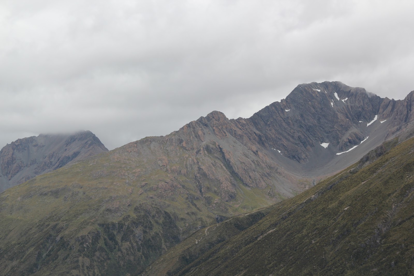
Re-edit: I took photos of two photos of the pass from a museum display so I could give you more perspective, they are blurry, but ok...

Sunday, January 23, 2011

Can an elephant cross the Alps?

Today the fellowship split so that josele could get to Greymouth, rent a car and do one of the most scenic drives in the world, the strech of oceanside road between Greymouth and Westport. I am sure he'll be back wiht lots of amazing pictures that we'll post when we can. I promise we are trying...
I on the other hand have had a very good but hard day of cycling up the Otira Alpine Road. I got to the village of Otira, with it's sprawling population of 2. It is a beautiful, beautiful valley and the mountains surrounding us are getting scarily "alpine" meaning big, high and covered in snow.
However, Otira is a very interesting place to stop because I am now only 11 kms away from the top of Arthur's Pass. I have also climbed half the height, but the remaining 10 kms are the source of whispered rumours between the bikers we meet: Smoke coming out of the brakes of descending bikers, slopes of 16%, others say 12%...
The actual route I am following has even got a name, the Coast to Coast and this morning I passed by a spot on the beach where it was specified that the Coast to Coast started there. Later that day, a lady in a shop asked me if I was attempting the Coast to Coast. I said yes, becaus actually if I get through the pass, the rest is flattish and downhill all the way down to Christchurch, so basically Coast to Coast. But what worried me was the term "attempting".
So what do you think, people? Can this old elephant, overwheight, with weak knees and not good cardio who is too fond of wine, cross the alps?